How to pinpoint a location on the survey map
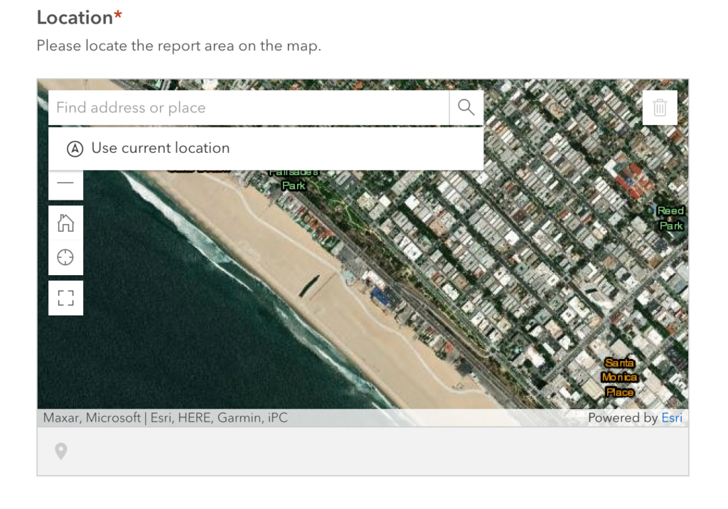
Before we begin the step-by-step instructions, let’s go over the different tools found on the map:
- The search bar is found at the top of the screen and can be used to find the address or place of your desired location. Further below, we will go over how you can use this.
- The “+” and “-” buttons on the left side of the screen are used for zooming in or out, respectively.
- The button with the house icon is used to reset the map to the default view.
- The button right below with the compass icon is used to find your current location on the map. In order to use this feature, make sure that location services are enabled by the internet browser or app you are currently using.
- The button with the square icon is used to make the map full screen.
- The button with the trash icon at the top right corner is used to delete a marker you have placed on the map. We will talk more about the markers further below.
First, simply click on the map with your cursor or finger.

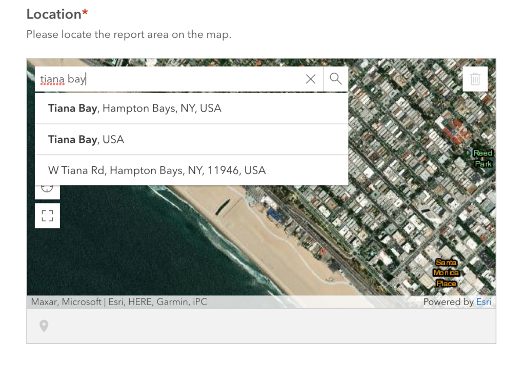
To begin, you must find the general location of the pollution incident on the map. Here you have several options to find your desired location. The survey website will first try to “use your current location” to automatically track where you are with your phone or computer. However, if you have this feature turned off, or you are no longer near the site of the pollution incident, there are other ways to find the report area.
You can either drag and drop across the map to find the location manually, or you can use the search bar. Clicking on the search bar you again see the option to “Use current location”. You can also type in the exact address, a town, village, or neighborhood name, a body of water, or other key words to help you find the general area.
Here I am using Tiana Bayside Facility in Hampton Bays as my example pollution report location. Since the exact location of “Tiana Bayside Facility” is not available in the search bar, I clicked on “Tiana Bay, Hampton Bays” since it’s in the same general area.
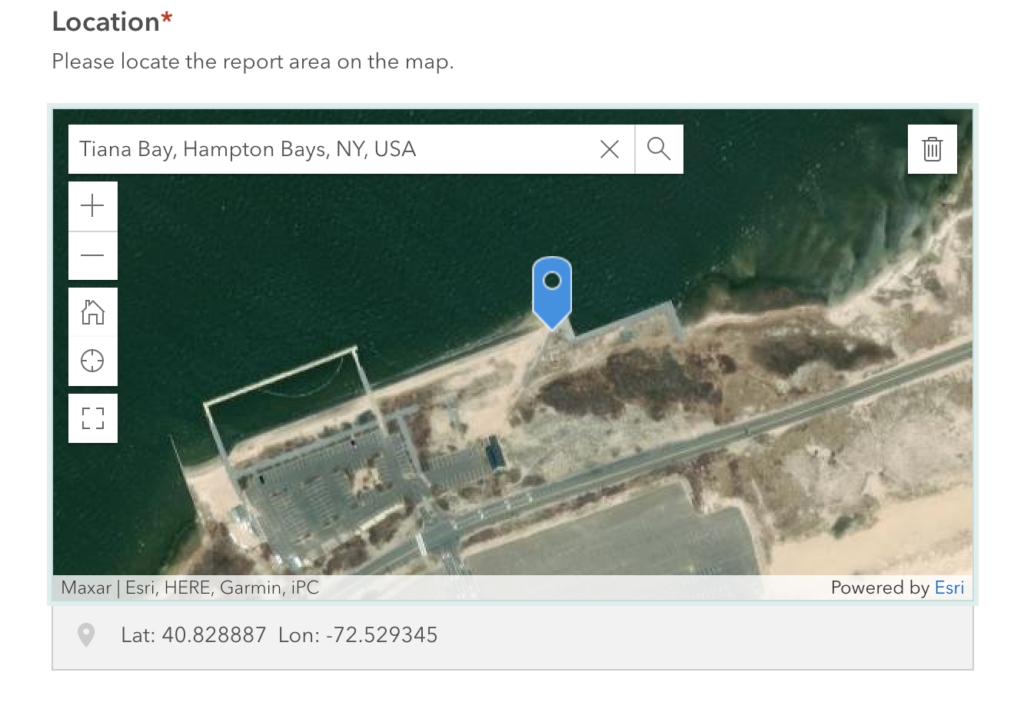
After clicking on this option, the site automatically places a blue marker at an approximate location for “Tiana Bay”. However, I want the marker to be on the pollution incident area. To find the exact location, use the “+” or “-” buttons on the left side of the map to zoom in or out.


After you find the exact location of the pollution incident, simply click on the map to place the blue marker. Please try to be as accurate as possible to facilitate us locating the pollution on the ground! This may require some zooming in.
Here, I found and zoomed in on the Tiana Bayside Facility. Clicking on the map again will place a new marker at that location. Don’t worry about deleting old markers because the map only allows one at a time! I zoomed in enough to pinpoint my “pollution incident” on the right side of the beach.
After finding your location and placing the marker, you are all set to continue with the rest of the survey! Of course, if you have further questions, please feel free to email us at info@peconicbaykeeper.org or call us at (631) 653-4804.