Project R.I.S.E.
Welcome to Project R.I.S.E.
Recording Inundation Surrounding the Estuary
Join Peconic Baykeeper in documenting coastal change in the Peconic Estuary through community science!
About Project R.I.S.E
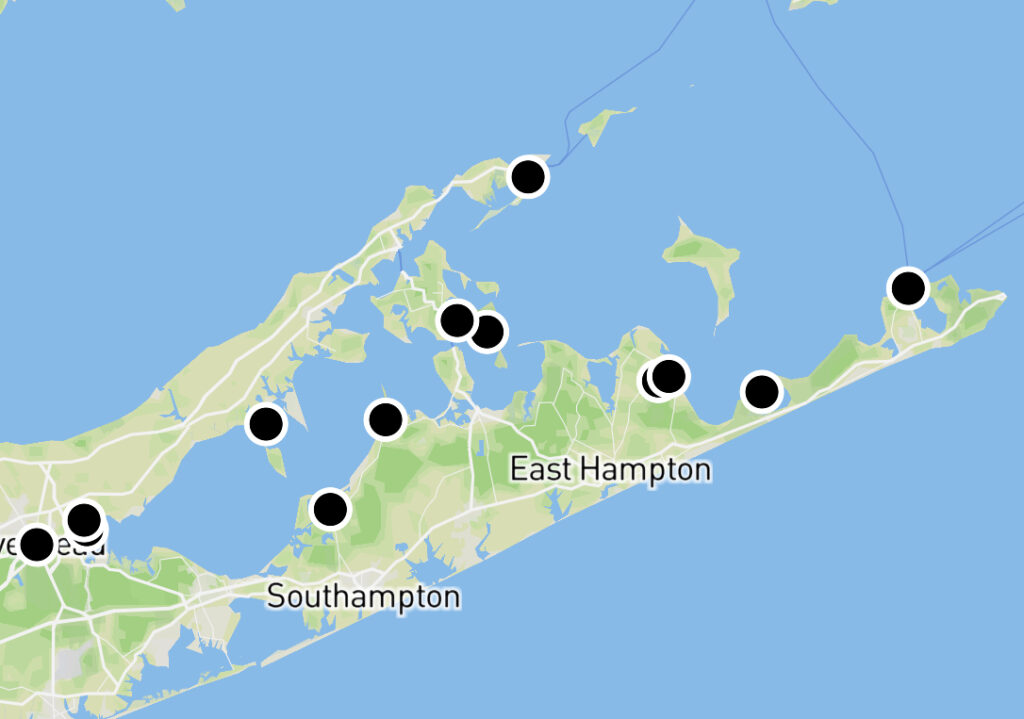
Project R.I.S.E (Recording Inundation Surrounding the Estuary), is a new innovative community science and outreach initiative led by Peconic Baykeeper and funded through the Peconic Estuary Partnership in support of their 2020 Comprehensive Conservation Management Plan. The goal of this project is to engage the public and raise awareness about the present and future impacts of climate change/sea level rise in the Peconic Estuary. This program currently includes 15 coastal sites around the Peconic Estuary hosted by 9 site partners with an initial funding timeline of 5 years.
How It Works
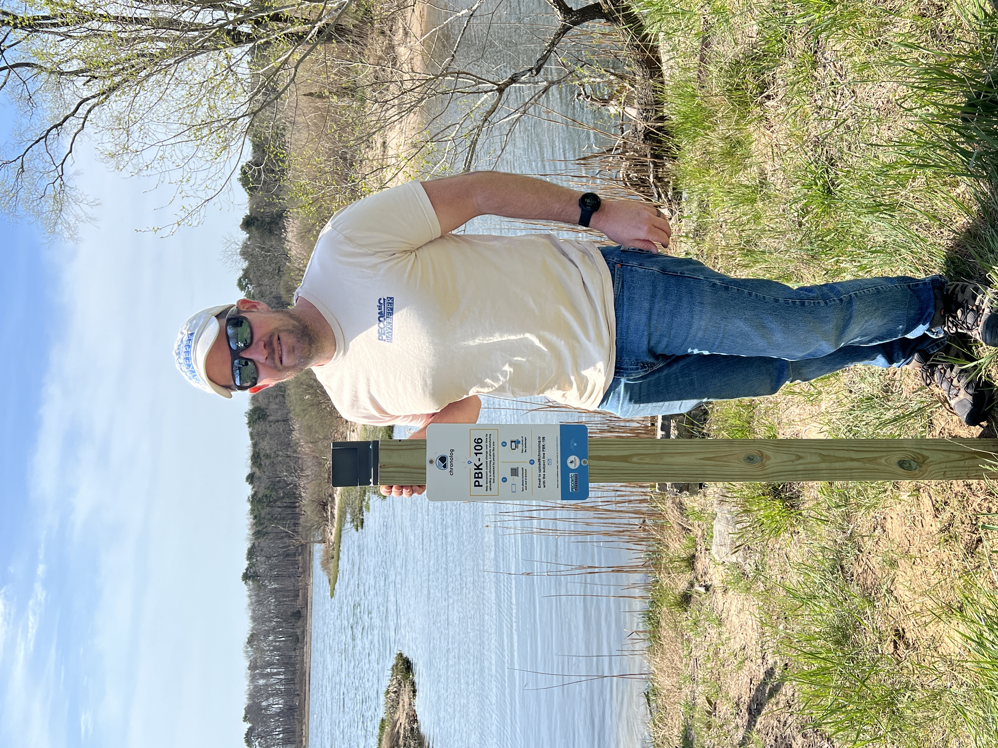
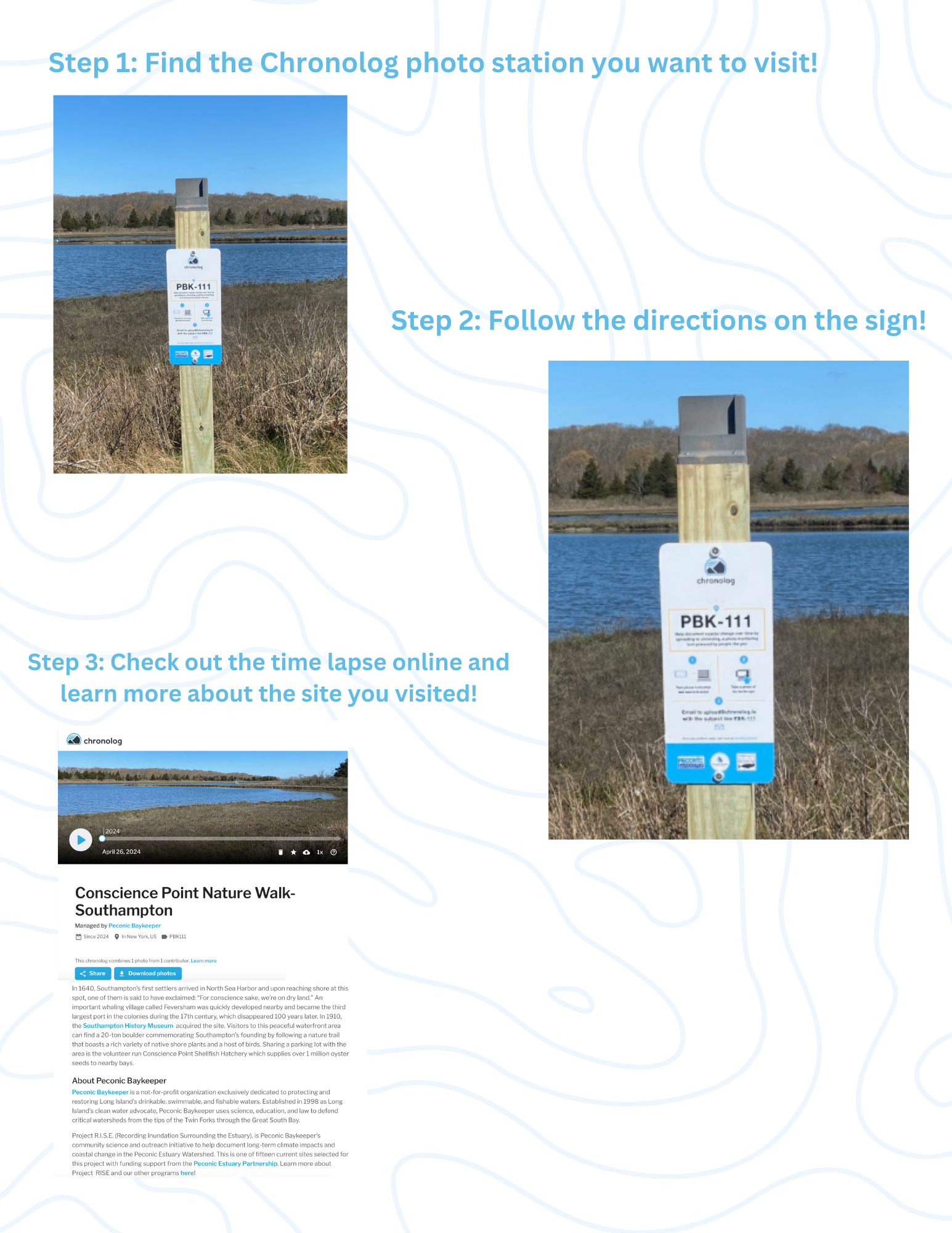
Using a community science tool called Chronolog, participants capture photos of the shoreline at each station using a specially designed phone cradle affixed to a 4×4 post. These photos are then submitted to Chronolog by following the prompts on the sign. Each submission is compiled in a chronological time lapse on a dedicated site webpage where participants participants can view their photos, explore those taken by others, and learn more about each location they visit. Additionally, these photos exist in the public domain and can be accessed, shared, and downloaded by the public.
Get Involved: Capture and Contribute
Join Peconic Baykeeper as we work to elevate public awareness about coastal changes over time in the Peconic Estuary Wateshed. Together we can RISE to the challenge and capture photos from the 15 sites around the Peconic Estuary.
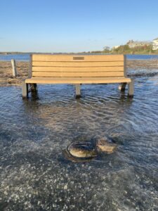
To participate in Project R.I.S.E and contribute to the documentation of coastal changes in the Peconic Estuary, all you need is your smartphone and the willingness to travel to one of our 15 monitoring sites. Once you’ve reached a site, simply place your smartphone in the affixed phone cradle to capture your image which can be shared via email by following the prompts on the sign. Your photo will then be included in the time lapse for the station you visited and you will have joined a growing group of engaged Community Scientists actively monitoring coastal change in the estuary! Your contributions will not only help track important environmental shifts at your site but will also raise awareness and drive action towards creating a better informed and more resilient Peconic Estuary Community. We highly encourage submissions of photos during extreme tidal flooding and weather events when it is safe to do so!
Project R.I.S.E. Brochure Click Here for a Self Guided Adventure!
Click Here to Visit Project R.I.S.E. Story Map!
Please note that Broad Cove is note currently open to the public, we will update this site when it is! Thank you!
Students and Teachers
Project R.I.S.E presents an exceptional opportunity for students and teachers to actively engage with nature while gaining valuable insights into coastal changes. By participating in this community science initiative, students can deepen their understanding of environmental science, climate change, and the importance of preserving our coastal ecosystems.
Teachers can incorporate Project R.I.S.E. into their curriculum, providing hands-on learning experiences for students. Whether through class field trips to monitoring sites, incorporating data collection into science projects, or participating in outreach events, students and teachers alike can play a vital role in documenting and addressing the impacts of climate change on our community. Join us in fostering a generation of environmentally conscious leaders by becoming part of Project R.I.S.E. today.
Explore the Time-lapse!
Thank You to Our Project Site Partners!
Peconic Land Trust • The Nature Conservancy • Riverhead Parks and Recreation • Suffolk County Parks • New Suffolk Waterfront Fund • U.S .Fish & Wildlife Service • Southampton Historical Museum • Town of East Hampton • East Hampton Town Trustees
Why Coastal Observation Matters on Eastern Long Island
Understanding Coastal Change
Eastern Long Island, including the Peconic Estuary, is a region of incredible natural beauty and ecological significance. However, it is also particularly vulnerable to the impacts of climate change, including sea-level rise, increased storm intensity, and shoreline erosion.
Rising Sea Levels
As global temperatures rise, so do sea levels. This poses a significant threat to coastal communities on eastern Long Island. Even a small increase in sea level can lead to more frequent and severe flooding, threatening homes, infrastructure, and natural habitats.
Intensified Storms
Climate change is also leading to more intense and frequent storms. Hurricanes, nor’easters, and other severe weather events can cause extensive damage to coastal areas, exacerbating erosion and flooding. These events pose a significant risk to both human communities and the delicate ecosystems of the Peconic Estuary.
Shoreline Erosion
The natural process of shoreline erosion is being accelerated by climate change. As sea levels rise and storms become more severe, beaches and coastal habitats are disappearing at an alarming rate. This not only impacts the beauty and recreational value of the area but also threatens the livelihoods of those who depend on the coast for fishing, tourism, and other industries.
Protecting Our Communities
By actively observing and documenting coastal changes through initiatives like Project R.I.S.E, we can better pinpoint areas more susceptible to the dynamics of shoreline erosion and flooding. This information is essential for developing effective strategies and policy to protect our communities, preserve our natural resources, and adapt to the challenges of a changing climate. Your participation in Project R.I.S.E is crucial for building a resilient future for eastern Long Island. Together, we can make a difference in understanding and addressing the impacts of climate change on our coastal communities.